
Phuket, Spatial Mobility and Accessibility
Mobility infrastructure defines how residents and visitors interact with Phuket’s territory. As an island destination heavily reliant on international arrivals, internal transport networks must handle intense daily movements between entry ports, coastal resort enclaves, commercial centres, and natural attractions. However, public transit deficits and high private vehicle reliance have created systemic traffic congestion, high carbon emissions, and reduced quality of life for residents.
11.1 Aviation and Maritime Transport Infrastructure
Phuket operates as a high-density international transit hub with major air and sea gateways:
- Phuket International Airport (HKT): Located in the far north of the island (Thalang District), HKT is Thailand’s second busiest airport. Handling over 18 million passenger movements annually at pre-pandemic peak capacity, the airport connects Phuket directly to major hubs in Europe, the Middle East, East Asia, and Australia. Its northern coastal location requires virtually all arriving visitors to travel south along a single primary road artery.
- Maritime Ports and Piers: Rassada Pier (Phuket City) and Chalong Pier (Mueang Phuket District) serve as the primary departure points for millions of excursionists traveling daily to Phang Nga Bay, Phi Phi Islands, and local satellite islands. Speedboat and long-tail boat operations at these piers generate localized noise pollution, fuel spills, and marine safety risks in shallow coastal waters.
11.2 Island Road Network and Congestion Bottlenecks
The island’s internal road network is structurally constrained by topography and historical development patterns:
┌─────────────────────────────────────────────────────────────────────────┐
│ PHUKET ROAD TRANSIT CORRIDORS │
└─────────────────────────────────────────────────────────────────────────┘
Northern Gateway (HKT Airport)
│
▼
[ Highway 402 Corridor ] ───► Extreme North-South Arterial Bottleneck
│
┌──────┴──────┐
▼ ▼
[Patong Hill] [Phuket City] ───► High-Risk Steep Pass & Urban Grid Lock
- Highway 402 Corridor: Highway 402 serves as the sole north-south arterial backbone connecting the airport to the rest of the island. Intersections along this corridor experience severe gridlock during high-season peak hours, delaying logistics, emergency services, and daily resident commutes.
- Patong Hill Pass (Route 4029): Connecting central Kathu to Patong Beach, this steep, winding mountain pass handles intense volumes of tour buses, delivery trucks, and motorbikes. It represents one of the highest road accident zones in the province and is highly vulnerable to slope failure during heavy monsoon rain.
11.3 Public Transit Deficits and Tourist Mobility Monopoly
Phuket lacks a comprehensive, high-capacity public transit system:
| Transit Mode | Operational Scope & Characteristics | Systemic Limitation / Vulnerability |
| Phuket Smart Bus | Private-public route operating along the west coast from HKT Airport to Rawai | Low frequency, shared road space with general traffic, limited capacity for large luggage. |
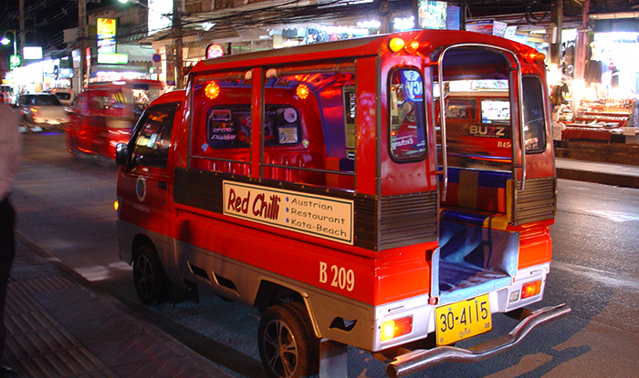
| Songthaew (Local Open-Air Buses) | Traditional wooden buses connecting Phuket City to outer beaches | Fixed radial routes terminating in Phuket City; no direct interconnectivity between adjacent western beaches; limited evening operation. |
| Tuk-Tuks and Private Taxis | Informal commercial transport oligopoly operating across resort zones | High fare structures compared to mainland Thailand; lack of metered transparency; resistance to integrated public bus expansion. |
| Private Motorbike Rentals | High volume of tourist and resident two-wheel transport | Primary contributor to provincial road traffic injuries and fatalities; high safety risk for inexperienced foreign drivers. |